River Kent
River in Cumbria, EnglandThe River Kent is a beautiful short river in the county of Cumbria in England. It originates in hills surrounding Kentmere, and flows for around 20 miles (32 km) into the north of Morecambe Bay. The upper reaches and the western bank of the estuary are located within the boundaries of the Lake District National Park. The river flows in a generally north to south direction, passing through Kentmere, Staveley, Burneside, Kendal and Sedgwick. Near Sedgwick, the river passes through a rock gorge which produces a number of low waterfalls. This section is popular with kayakers as it offers high quality whitewater for several days after rain. The village of Arnside is situated on the east bank of the Kent estuary, just above Morecambe Bay, and a tidal bore known as the Arnside Bore forms in the estuary at this point on high spring tides.
Read article


Top Questions
AI generatedMore questions
Nearby Places

Heversham
Village and civil parish in Cumbria, England

Levens Hall
Manor house in Cumbria, England

Hincaster
Hamlet and civil parish in Cumbria, England

River Gilpin
River in Cumbria, England

Levens, Cumbria
Village in Cumbria, England
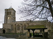
St Peter's Church, Heversham
Church in Cumbria, England
Causeway End
Hamlet in Cumbria, England
Heversham railway station
Former railway station in England